Munnar & Alleppey 3 Night 4 Days 2 Pax Itinerary Day 1: Cochin to Munnar Pick up and proceed to...
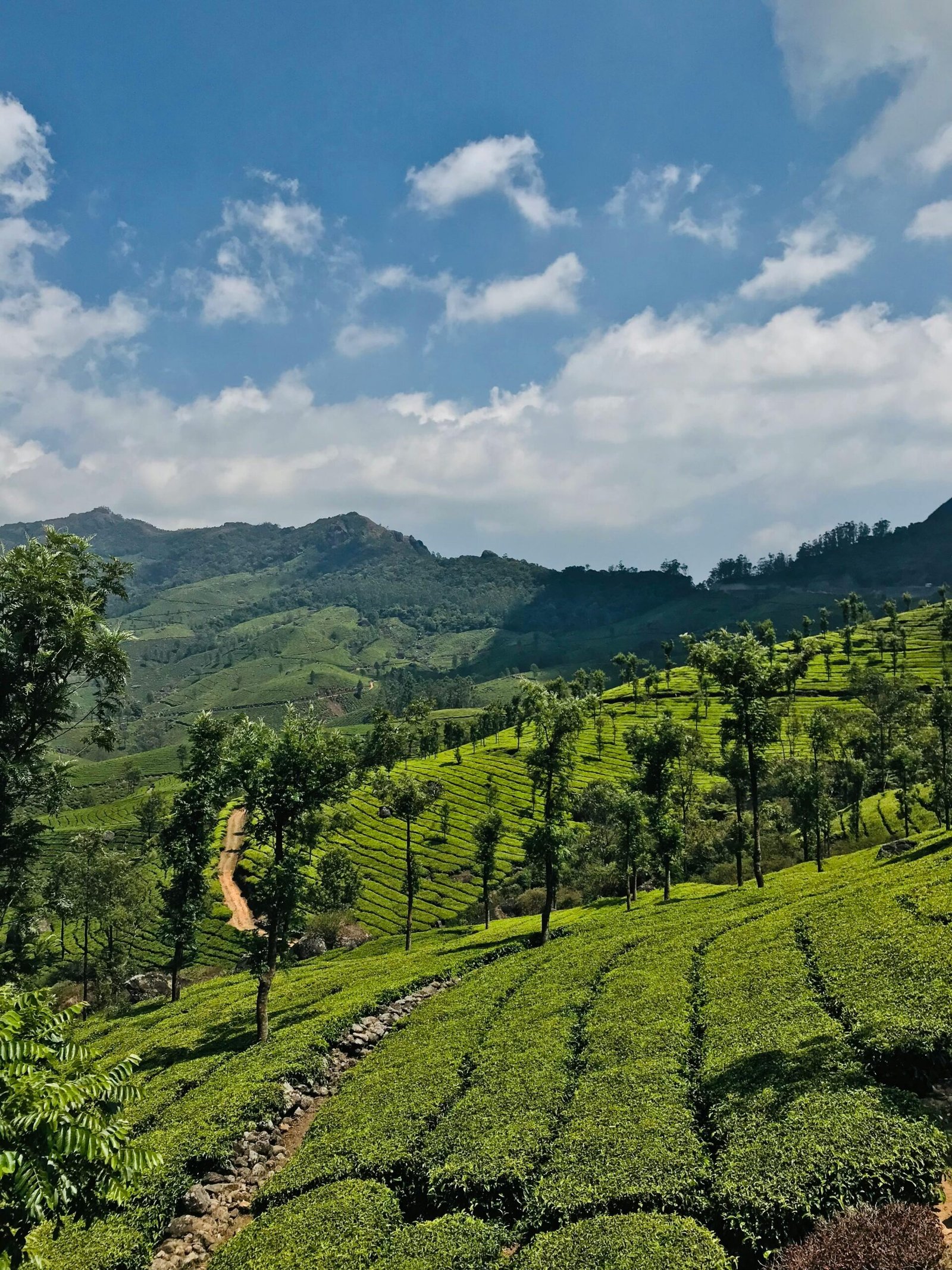
There is a reason Wayanad appears on almost every Kerala travel list published in the last five years. The district sits at an altitude of 700 to 2100 metres, covered in coffee and tea estates, dense rainforest, open grasslands, and mist that rolls in from the Western Ghats every evening without fail. It is, in short, the kind of place that photographs itself.
However, Wayanad is also more than its photographs suggest. It is home to the largest concentration of tribal communities in Kerala. It holds some of the most significant prehistoric rock carvings in South Asia. Its forests are part of the Nilgiri Biosphere Reserve — the largest biosphere reserve in India. And its food culture, shaped by both the tribal communities and the estate workers who have lived here for generations, is unlike anything found on the Kerala coast.
If your Kerala itinerary includes the southern stretch — and our 7 Nights 8 Days Kerala package does — Thiruvananthapuram is where the journey reaches its most historically rich point. This guide covers everything you need to know: what to see, how to plan your time, the best areas to stay, what to eat, and when to go.
Munnar & Alleppey 3 Night 4 Days 2 Pax Itinerary Day 1: Cochin to Munnar Pick up and proceed to...
8-Day Enchanting Kerala Escape Itinerary Day 1: Arrival at Cochin Pick up at cochin, visit Dutch palace, Jewish synagogue, chinese...
6-Day Enchanting Kerala Escape Itinerary Day 1: Arrival at Cochin Pick-up: Cochin Airport / Railway Station Proceed to hotel check-in...
India’s largest earthen dam.
Three-tiered waterfall in dense forest.
Part of the Nilgiri Biosphere.
Massive falls accessible via a forest trek.
Neolithic rock carvings.
Natural freshwater lake shaped like India's map.
The "Kashi of the South" on Brahmagiri Hills.
Heart-shaped lake and trekking.
River delta with bamboo rafting.
Gateway to Wayanad with misty views.
Wayanad is a plateau district. Unlike Munnar, which is a single hill station town surrounded by tea gardens, Wayanad is an entire elevated landscape — a broad tableland in the Western Ghats, bordered by Karnataka to the north, Tamil Nadu to the east, Kozhikode to the west, and Malappuram to the southwest.
The district has three main towns: Kalpetta (the district headquarters), Mananthavady (in the north), and Sulthan Bathery (in the east). Each functions as a base for different parts of the district. In fact, Wayanad is large enough that choosing your base thoughtfully matters — Kalpetta gives access to Chembra Peak and the western forests, Sulthan Bathery is the entry point for Edakkal Caves and Muthanga Wildlife Sanctuary, and Mananthavady sits closest to the Brahmagiri Hills and the Karnataka border forests.
Most travellers stay in Kalpetta or the resort belt between Kalpetta and Vythiri. That is a reasonable choice. However, it means the eastern and northern parts of the district — often the most interesting — require longer drives.
At 2,100 metres above sea level, Chembra Peak is the highest point in Wayanad and one of the most popular treks in Kerala. The trail starts from Meppadi, about 8 kilometres from Kalpetta, and climbs through tea gardens, grassland, and shola forest to a heart-shaped lake near the summit — and then to the peak itself.
The heart-shaped lake — locally called Hridayathadakam — sits at around 1,700 metres and is the point most trekkers photograph. It is a naturally formed lake in a grass-lined depression that holds its shape across seasons. On clear days, the view from the lake across the Wayanad plateau and the forests below is extensive.
The full trek to the summit and back takes 5 to 6 hours. The trail requires a Forest Department permit, available at the base camp at Meppadi. A guide is mandatory — this is enforced, not optional. Permits are limited daily, which means arriving early is essential during peak season.
However, the trek has become significantly more popular in the last three years. Consequently, weekends from November to February see large groups on the trail, which changes the experience considerably. Therefore, if possible, go on a weekday. The permit process is the same, the views are identical, and the trail is noticeably quieter.
Thirty kilometres east of Kalpetta, near Sulthan Bathery, the Edakkal Caves are not caves in the conventional sense. They are a natural rock fissure — a long, narrow cleft in the Ambukuthi hill, formed by geological pressure over millions of years — with walls covered in petroglyphs that archaeologists date to between 6,000 and 8,000 years old.
The carvings include human figures, animals, geometric patterns, and what appear to be early writing symbols that some scholars associate with the Indus Valley civilisation. Whether that connection is accurate remains debated. What is not debated is that these are among the oldest rock carvings in South Asia and that their presence in a forest hill in Wayanad raises questions about early human settlement in the Western Ghats that have not been fully answered.
The climb to the caves involves about 1.5 kilometres of uphill walking on a paved path — not difficult, but steady. The narrow fissure at the top requires some agility to enter. Inside, the carvings are protected behind barriers but clearly visible. The context provided by signage inside the caves is useful.
Worth noting: Edakkal is crowded on weekends. Visiting on a weekday morning — the site opens at 9 AM — gives significantly better access and more time to observe the carvings without the pressure of a queue behind you.
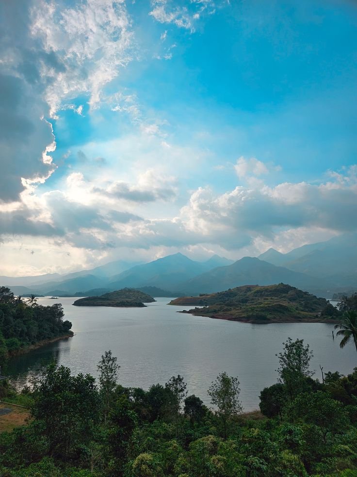
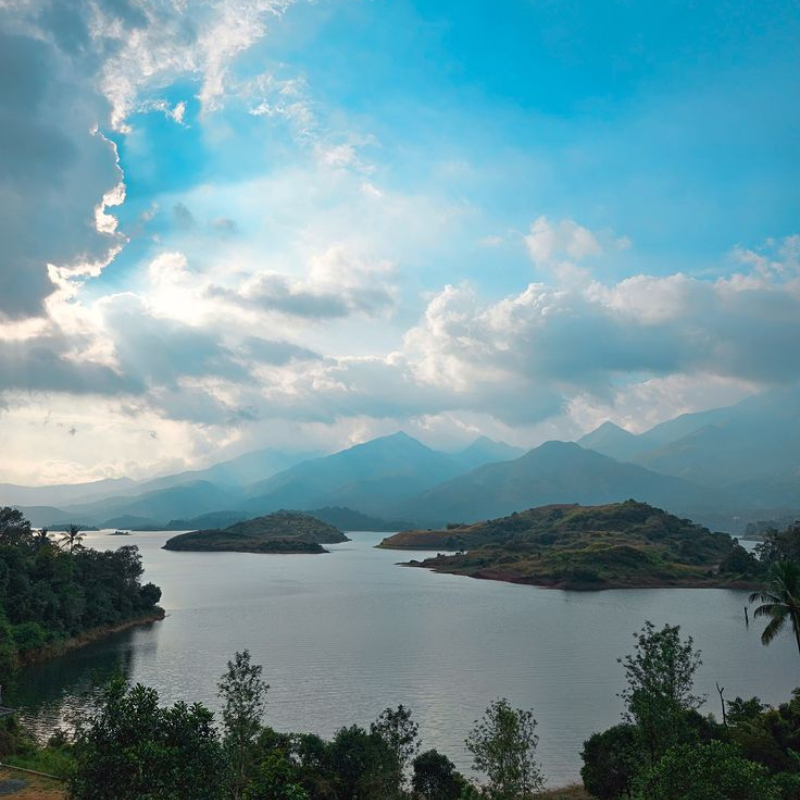
Eighteen kilometres from Kalpetta, in the Padinharathara area, is the Banasura Sagar Dam — the largest earthen dam in India and the second largest in Asia. The dam is built on the Kabani River tributary and creates a reservoir that stretches into the surrounding forested hills.
What makes Banasura Sagar worth visiting is not primarily the dam engineering — impressive as the scale is — but the landscape it creates. The reservoir is dotted with small islands that emerge from the water during the summer months when the level drops. Boat rides between these islands, with the forested Banasura Hills rising behind them, produce a visual combination that is specific to this location and found nowhere else in Kerala.
In addition, the Banasura Hill trek starts from near the dam and offers a 4-hour route through grassland and forest to a summit at 2,073 metres. It is less crowded than Chembra Peak because it is less publicised. Furthermore, the trail passes through a wider variety of vegetation zones — from the waterside forest at the base to the high grassland near the summit.
The dam area is pleasant even without trekking. The drive along the reservoir edge, the boat ride, and the walk along the bund give a full morning’s worth of activity without requiring any special preparation.
The Wayanad Wildlife Sanctuary covers 344 square kilometres across two ranges: Muthanga in the east and Tholpetty in the north. Both are part of the larger Nilgiri Biosphere Reserve — a continuous forest block that connects with Nagarhole and Bandipur in Karnataka and Mudumalai in Tamil Nadu to form one of the largest protected forest systems in South Asia.
Muthanga Range is 16 kilometres from Sulthan Bathery. Jeep safaris operate in the morning (6 to 9 AM) and evening (3 to 6 PM). The forest here is mixed deciduous with open grassland sections — the kind of habitat that supports large mammals and makes sightings relatively accessible. Elephant herds are commonly seen, particularly at the waterholes in the dry season. Gaur, spotted deer, sambar, wild boar, and langur are regularly encountered. Tiger and leopard are present in the reserve but sightings are infrequent.
Tholpetty Range is further north, near Mananthavady, and operates on the same safari schedule. The forest here is denser and the atmosphere is quieter — fewer visitors make the journey this far north. As a result, Tholpetty often delivers a more intimate wildlife experience than Muthanga despite similar species diversity.
Both ranges require advance booking during peak season. Walk-in permits are available but the jeep slots fill early. The Forest Department booking portal is the official channel — third-party agents charge significantly more for the same access.
Three kilometres from Vythiri, set inside a forest at 770 metres altitude, Pookode Lake is a freshwater lake surrounded by subtropical forest that functions as one of Wayanad’s most accessible natural sites.
The lake is small — you can walk the perimeter in about 30 minutes. Pedal boats are available. The aquarium at the lake edge houses freshwater fish species from the Western Ghats, including several endemic species that most visitors have never seen. The forest walk above the lake is a quiet 45-minute circuit.
Pookode is not the most dramatic destination in Wayanad. However, it is genuinely peaceful and consistently beautiful — particularly in the early morning when mist sits on the water and the forest edge is active with birds. Unlike the major trekking sites, it requires no permit and no physical preparation. Therefore, it works well as a morning stop on the way to or from Kalpetta.
Wayanad has several waterfalls. However, two dominate the searches and the conversations among travellers who have been: Soochipara and Meenmutty.
Soochipara Falls (also called Sentinel Rock Waterfalls) is 22 kilometres from Kalpetta. The falls drop approximately 200 metres in three tiers into a pool at the base. The trek to the falls takes about 45 minutes each way through forest. Swimming is permitted in the lower pool during safe water levels. The combination of the forest walk and the falls makes it a 3-hour visit.
Meenmutty Falls is 29 kilometres from Kalpetta and larger — a 300-metre three-tiered cascade that is one of the tallest waterfalls in Kerala. The trek to the base is more demanding than Soochipara — about 2 kilometres of steep downhill through forest, which means the return climb is strenuous. As a result, it suits reasonably fit travellers and rewards those who make the effort with a falls at genuinely impressive scale.
Which one should you choose? If time allows only one, Meenmutty is the more dramatic. If you want a more accessible visit with swimming, Soochipara is the practical choice. In fact, the two are in different directions from Kalpetta — so combining them requires a full day of driving.
Thirty-two kilometres north of Mananthavady, in a valley surrounded by forest near the Karnataka border, is the Thirunelli Temple — one of the oldest Vishnu temples in Kerala and one of the most atmospheric heritage sites in Wayanad.
The temple was built in the Kerala style using the granite of the surrounding hills. The columns of the outer mandapa are single pieces of rock, uncut and unjoined at the base — they have stood in the same position for over a thousand years. The Papanasini stream that runs adjacent to the temple is considered sacred for performing last rites — Wayanad’s tribal communities have used this site for ancestral rituals for as long as recorded history exists here.
What makes Thirunelli exceptional is not the architecture alone. It is the setting. The temple sits in a valley enclosed by forest on all sides. The Brahmagiri Hills rise directly behind it. The air is cool and noticeably different from the rest of Wayanad. The drive to reach it — through increasingly dense forest with occasional wildlife on the road — is itself part of the experience.
Most importantly, because Thirunelli is far from the main Kalpetta resort belt, it receives far fewer casual visitors than Edakkal or Chembra. Consequently, the atmosphere here is genuinely contemplative in a way that the more visited sites cannot match.
Wayanad has the largest tribal population of any district in Kerala. The Adivasi communities here — including the Paniya, Kurichya, Kuruma, Adiya, and Kattunayakan peoples — have lived in these forests for thousands of years. Their relationship with the landscape is inseparable from what makes Wayanad ecologically and culturally significant.
In recent years, tribal tourism has become a growing part of Wayanad’s visitor economy. Several community-run tourism initiatives offer village visits, traditional craft demonstrations, forest walks with tribal guides, and cultural programmes.
However, this is an area where the quality and ethics of the experience vary significantly between operators. Some programmes are genuinely community-led, economically beneficial to the tribal households involved, and educational for visitors. Others are performative arrangements where communities display themselves for external consumption with limited real benefit flowing back.
Therefore, if tribal cultural visits interest you, choose operators who are explicit about community ownership and revenue sharing. The Wayanad Social Service Society and several NGO-linked operators run programmes that meet this standard. Ask specific questions before booking.
Wayanad produces a significant proportion of India’s coffee — both Arabica and Robusta — along with tea, pepper, cardamom, and vanilla. The estate landscape that results from this agriculture is one of the defining visual experiences of the district.
Plantation homestays and estate resorts have become one of the most popular accommodation formats in Wayanad. Staying within a working estate — waking to the smell of coffee blossoms, walking between the rows before breakfast, watching the morning mist burn off the canopy above the pepper vines — is a fundamentally different experience from staying at a standalone resort.
The best plantation stays involve actual access to the working process — estate tours that show coffee picking, processing, and sun-drying, or pepper harvest demonstrations during October and November. Simply sleeping in a building surrounded by plants without any engagement with the agriculture is less interesting and rarely worth a premium price.
That said, accommodation quality and the genuineness of estate access vary widely. Reading recent traveller reviews specifically for mentions of the estate tour and breakfast quality — rather than just room photographs — gives a better picture of what to expect.
Seventeen kilometres from Mananthavady, the Kabani River splits around a set of uninhabited river islands covered in dense riverine forest. This is Kuruva Island — a protected cluster of islands accessible only by bamboo raft, covering approximately 950 acres of forest that the Forest Department has maintained in a near-pristine state.
The bamboo raft crossing takes a few minutes. Once on the island, the walking trails cover about 3 kilometres through forest that is different in character from the surrounding plantation landscape — taller trees, denser canopy, the sound of the river audible from most points on the trail. Rare orchids, giant squirrels, and various kingfisher species are regularly sighted.
The island is closed during monsoon — June through August — when the river level makes the crossing unsafe. Between September and May, it is open from 9 AM to 4 PM. Entry is managed by the Forest Department. Given that the island has no permanent human population and limited visitor numbers per day, it retains a wildness that most accessible natural sites in Kerala have lost.
Most Wayanad itineraries mention Chembra and Edakkal. Fewer mention the two viewpoints that offer some of the most striking perspectives on the plateau landscape without requiring a strenuous trek.
Phantom Rock near Kalpetta is a natural granite boulder formation perched on a hillside that overlooks the Wayanad plateau. The boulders are large enough to walk around and between. The view from the highest point covers the agricultural patchwork of the plateau — coffee estates, paddy fields, forest patches — stretching to the hills on the Karnataka and Tamil Nadu borders.
Glass View is a viewpoint on the Kalpetta-Kozhikode road that looks westward down the Thamarassery Ghat — the drop from the Wayanad plateau to the Kozhikode coastal plain. On clear mornings, the view extends across the plain toward the sea. The descent visible from here — the road hairpinning sharply down a forested hillside — is dramatic in a way that is best appreciated from above before you drive it.
Both viewpoints are accessible without permits, take less than an hour to visit, and are therefore practical additions to any Wayanad day rather than full itinerary items in their own right.
Wayanad’s food culture is shaped by three distinct influences: the tribal communities who have cooked from the forest for generations, the estate worker communities who brought their own traditions from different parts of Kerala, and the coffee and spice agriculture that determines what is locally abundant.
Bamboo Rice (Mulayari): This is perhaps the most distinctive ingredient associated with Wayanad’s tribal food culture. Bamboo rice is not a cultivated grain — it is the seed produced by bamboo plants when they flower, which happens rarely and unpredictably. The grain is slightly sweet, greenish when fresh, and has a flavour and texture entirely unlike paddy rice. Tribal communities in Wayanad have eaten it for generations. It appears at certain restaurants in Kalpetta and at tribal cuisine programmes — eating it here, where it originates, is the correct context.
Kaalan: A thick, tangy curry made from raw banana or yam in a coconut and yoghurt base — spiced with turmeric and black pepper. It is a central Kerala dish but the version in Wayanad uses the specific varieties of raw banana grown in the district, which have a different flavour from the coastal varieties.
Puttu with Forest Honey: Steamed rice cylinders — the standard Kerala breakfast — eaten with fresh honey from forest beehives maintained by tribal communities. The honey from Wayanad’s forests has a flavour that varies with the flowering season of the surrounding trees. Buying a small bottle of this honey directly from a tribal producer is one of the more worthwhile food purchases available in the district.
Estate-grown Filter Coffee: Wayanad grows the coffee. Therefore, filter coffee here is made from beans that were harvested within a few kilometres, roasted locally, and ground fresh. The difference between this and packaged coffee is immediate and significant. Small estate cafes and the better homestays serve it properly — strong, with the bloom from fresh grinding still active.
| Season | Months | What to Expect |
|---|---|---|
| Peak / Best | October – February | Cool, clear, ideal for trekking, wildlife, and estate visits |
| Shoulder | March – May | Warmer, drier, less crowded, waterfalls reduced |
| Monsoon | June – September | Heavy rain, extraordinary green, leeches on forest trails, some roads difficult |
| Post-monsoon | October | Forest is lush, waterfalls running strong, wildlife active after rains |
October is consistently the best single month in Wayanad. The monsoon has just ended. The forest is intensely green. The waterfalls are still running at significant volume. The air is cool and clear. Tourist density has not yet reached November-December peak levels. If you have flexibility in your travel dates, aim for the first two weeks of October without hesitation.
Monsoon Wayanad — June through August — is genuinely beautiful if rain does not bother you. However, leeches on forest trails are unavoidable during this period, some roads become difficult, and several attractions including Kuruva Island close entirely. Go in the monsoon only if you are specifically seeking the experience of a rainforest during its most active season.
From Kozhikode by Road: The most common route — 76 kilometres via the Thamarassery Ghat Pass, approximately 2.5 hours. The ghat road climbs through 11 hairpin bends and is one of the most scenic drives in north Kerala. The temperature drop as you ascend is immediate and significant.
From Mysore by Road: 95 kilometres via the Vythiri-Mananthavady route, approximately 2.5 hours through the Bandipur and Nagarhole forest corridors. This route passes through the Karnataka wildlife zone and wildlife sightings on the road are common, particularly in the early morning.
From Ooty by Road: 115 kilometres via Gudalur and Sulthan Bathery, approximately 3 hours. This enters Wayanad from the Tamil Nadu side — a practical option for travellers combining a Kerala and Tamil Nadu circuit.
Nearest Airport: Calicut International Airport, Kozhikode — 76 kilometres from Kalpetta. Transfer time approximately 2.5 hours.
Nearest Railway Station: Kozhikode Railway Station — 76 kilometres from Kalpetta. Taxis and shared jeeps operate regularly between Kozhikode station and Kalpetta.
Wayanad works naturally as a northern extension of the Kerala circuit, most logically approached through Kozhikode. For travellers covering the standard south and central Kerala circuit first — Cochin, Munnar, Thekkady, Alappuzha — adding Wayanad at the end via Kozhikode creates a comprehensive west-to-north arc.
Minimum recommended stay: 2 nights. Covers Chembra or Banasura trek, Edakkal Caves, Pookode Lake, and one waterfall.
Ideal stay: 3 nights. Adds a wildlife safari at Muthanga or Tholpetty, Thirunelli Temple, Kuruva Island, and a proper plantation estate visit.
Extended stay: 4 to 5 nights. Covers the full district including the northern areas around Mananthavady, the Brahmagiri Hills, and a tribal culture programme.
For all current Kerala packages and custom itinerary enquiries:
View 5 Nights 6 Days Kerala Package → https://bestkeralatourpackages.com/trips/kerala-tour-package-5-nights-6-days/
View 7 Nights 8 Days Kerala Package → https://bestkeralatourpackages.com/trips/kerala-tour-package-7-nights-8-days/
View all packages → https://bestkeralatourpackages.com/trips/
Contact us for custom itineraries → https://bestkeralatourpackages.com/contact/
| Details | |
|---|---|
| Best known for | Chembra Peak, Edakkal Caves, coffee estates, wildlife |
| Top attraction | Edakkal Caves prehistoric petroglyphs |
| Best trek | Chembra Peak (full day) or Banasura Hill (quieter) |
| Hidden gem | Thirunelli Temple in deep northern forest |
| Best waterfall | Meenmutty (dramatic) or Soochipara (accessible) |
| Best time to visit | October – February |
| Nearest airport | Calicut International Airport, Kozhikode (76 km) |
| Suits | Trekkers, wildlife seekers, coffee lovers, cultural travellers |
By Kerala standards, yes. Temperatures in December and January drop to 10 to 13°C at night and 18 to 22°C during the day. A light jacket or warm layer is essential from November through February, particularly in the early morning and evening. By March, temperatures rise again. In summer (April to May), daytime temperatures reach 30°C but nights remain cooler than the coast.
Yes — Wayanad is one of the better Kerala districts for family travel with children. Pookode Lake, the Banasura Dam boat rides, Kuruva Island, and the estate walks are all child-friendly. The Chembra summit trek is demanding for young children, but the trail to the heart-shaped lake is manageable for children above 8 years with reasonable fitness.
June through August sees the heaviest rainfall. September tapers off. By October, the monsoon has largely ended and conditions are ideal. November through February is the driest and coolest period.
The trek to the heart-shaped lake — about halfway to the summit — is manageable for most people with moderate fitness. The full summit trek is more demanding. Steep sections and uneven terrain mean proper footwear is essential. A guide is mandatory regardless of experience level and is arranged at the Meppadi base camp.




Best Kerala Tour Packages is a specialized division of
Pravas Sukhacha™
Network & Ecosystem.
Pravas Sukhacha Office 201, 2nd Floor, Raigad Complex, Salatwada Main Road, Vadodara – 390001, Gujarat
Business Hours:
Monday to Saturday: 10:00 AM – 7:00 PM
Sunday: Closed
Copyright © 2026 All Right Reserved BEST KERALA TOUR PACKAGES